
Early morning on Monday April 5th 2021 saw an interesting weather pattern shift that was very noticeable in almost all reading types; temperature, pressure, wind direction and air quality.
Weather reports had already predicted that in the night towards Monday, polar air would enter the Netherlands, temperatures at altitude would drop to -40 and we’d see a period of colder weather combined with snow and hail. A low pressure system over Scandinavia (with its counter clockwise rotation) and a higher pressure system over the Atlantic will combine forces to create a strong circulation from the Northwest.
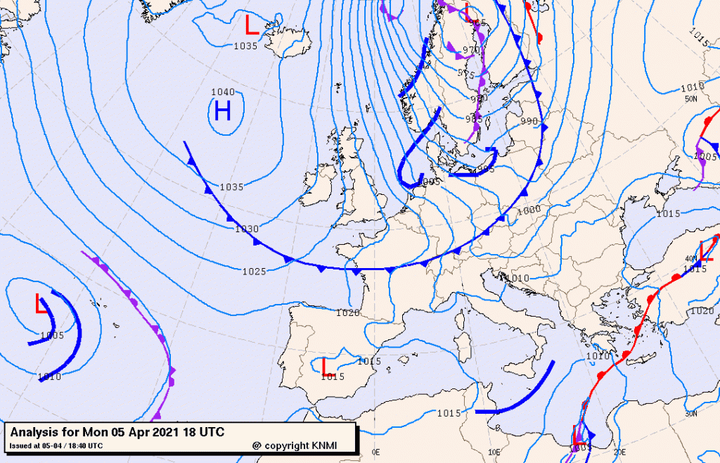
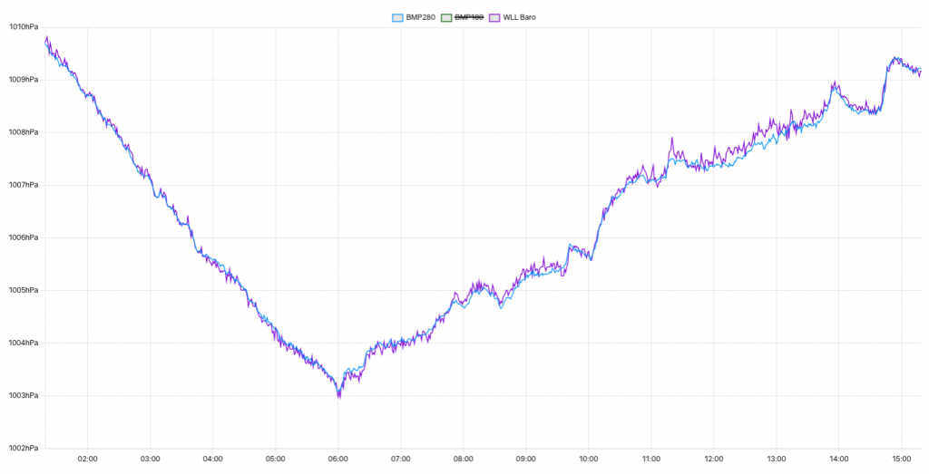
The shift occurred at 6 AM. The first graph of interest is the pressure graph.
During Sunday, the low pressure area over Scandinavia is gaining influence. After 6AM, winds start turning Northeast. Note that air pressure starts rising slowly afterwards in the border area between the aforementioned pressure systems.
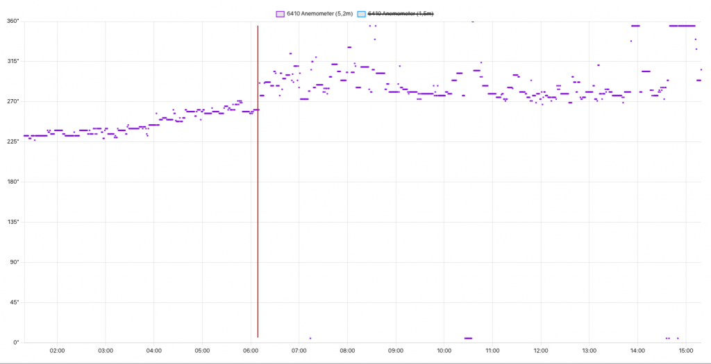
Winds, which had been creeping from Southwest (225 degrees) to West (270 degrees) during the night, settle Northeast after 6AM.
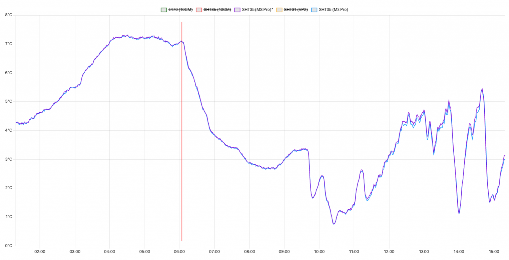
Most notably, temperatures start to drop as the colder arctic air flows over the Netherlands.
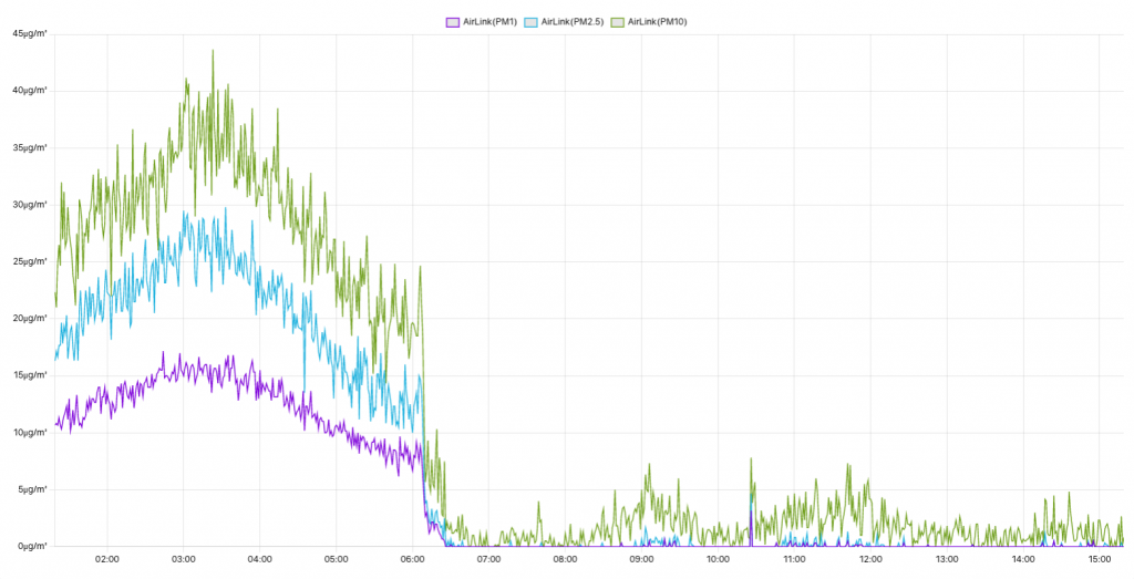
Possibly the most extreme indicator of a change is the air quality graph. Air from the North Atlantic is a lot cleaner. Particulate matter values plummet towards near zero.
April has been a cold month until now (April 12). Average temperatures at the Meteodrenthe weather station are stuck at 4,6 degrees. The coming nights are expected to be cold, with temperatures around or below freezing. Long term forecasts into late April show no indication of a major pattern change in terms of temperatures. With 9,9 degrees being ‘normal’ at the closest KNMI weather station, it appears that April is well on its way towards being not only the 4th ‘cold’ month in the a row for 2021, but also significantly so.